Remote Sensing
Lidar, Radar and Geophysics


Services
AMS offers a range of remote sensing services that utilise the most advanced technologies and state-of-the-art equipment to locate and map subsurface archaeological remains. Typically deployed at pre-planning and design stage, remote sensing helps our clients to minimise archaeological risk to project schedules and enhance confidence in the successful delivery of development projects.
Operating across Ireland and the UK, our dedicated survey team provides magnetometry, earth resistance, electromagnetic induction, ground penetrating radar and metal detection surveys, as well as Lidar capture and analysis.
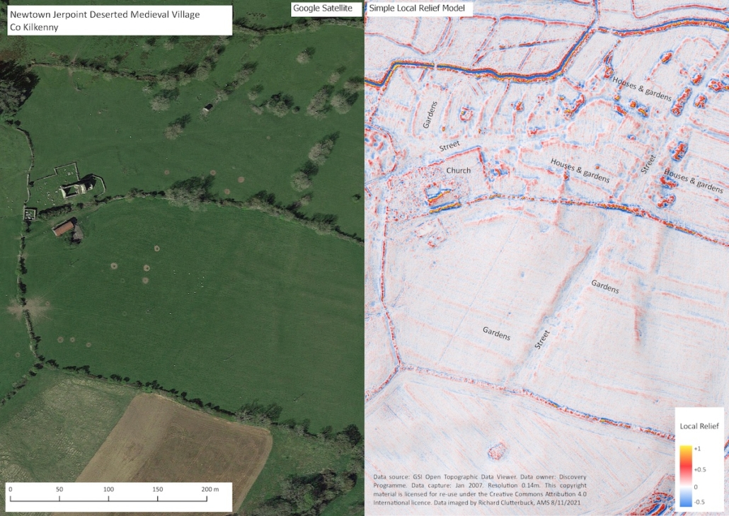
Lidar (Light Detection and Ranging) is a remote sensing technique used to generate high-resolution 3D models of the ground surface which can help archaeologists identify and record various aspects of the historic environment.
The processed data can be manipulated by a range of techniques and software that can aid in the discovery of low-profile archaeological features, including those hidden beneath woodland canopy.
Some of the main visualisation techniques for Lidar data include:
- Analytical hill-shading: artificial illumination is used to highlight surface changes such as upstanding features (mounds, walls etc.) and sunken features (ditches etc.). Greater illumination can be achieved by calculating analytical hill-shading in multiple directions equally distributed between 0° and 360°.
- Principal Components Analysis: a mathematical model that ‘summarises’ the information of hill-shade models from different directions.
- Sky-view factor: measures the portion of the sky visible above a certain point. In this way, flat terrain, ridges and earthworks which receive more illumination are highlighted and appear in light, while depressions appear dark because they receive less illumination.
- Slope gradient: represents the maximum rate of change between each data cell and its neighbours and can be calculated either as degree of slope or as percentage of slope. This technique works especially well in combination with hill-shading and also works well on most types of terrain.
- Openness: is a proxy for diffuse illumination. Positive Openness is similar to sky-view factor but with a more ‘flattened feel’, while Negative Openness provides additional information on convex features.
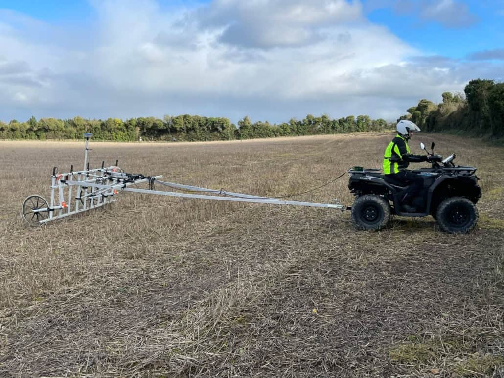

Electromagnetic Induction (EMI)
EMI simultaneously measures the quadrature (conductivity) and in-phase (magnetic susceptibility) components of a soil volume, allowing for the detection of infilled features such as ditches and pits, as well as structural remains such as buried foundations. This technique can detect archaeological features to a depth of 3.2m.

Earth Resistance
This technique measures variations in the moisture content of the soil and can identify and map buried stone features (such as walls and roadways) and silted-up ditches.

Ground-Penetrating Radar (GPR)
GPR is generally used for the detection of building foundations and burial remains and records the two-way travel time of electromagnetic energy transmitted from the surface through the underlying soil.

Metal Detection
Deployed as part of initial site assessments, metal detection is an effective method of investigation used to identify and map metallic objects in the topsoil, including archaeological artefacts. Our experienced detectorists use advanced equipment and operate under special licences from the Irish Government in line with legal requirements.